Ireland
Long Island Local Carriage Service

Long Island Local Carriage Service Stamps


Only accessible by boat, Long Island, historically called Inishfada (meaning "long island"), is an island that lies south of Schull, County Cork, Ireland. Although it had a population of more than 300 in the 1840s, its permanent population is now ten or less. The island's name comes from the fact that it is 4.8 km long and only 0.8 km wide. Copper Point lighthouse at its eastern end marks the entrance to Schull Harbour.
The island has a section of surfaced road and an overgrown road that extends to an old copper mine. Farming is now the primary economic activity on the island and there is a regular ferry service from Colla Pier to the island, operating 5 days a week during the summer months and three days a week during the winter months. Electricity is supplied through a submarine power cable.
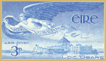
With fewer than forty people living on the island when 60 000 sets of local carriage service stamps were issued in 1973, there can be little doubt that their main targets were tourist and philatelic markets. The presentation folder pictured here is one of five thousand explicitly "prepared for collectors and the philatelic trade".
Bibliography
"Long Island, Cork County."